




P.M. United Nations World Geospatial International Congress held.
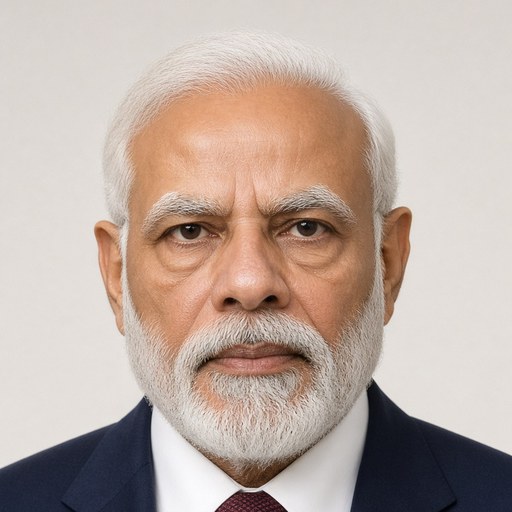
 Narendra Modi · Prime Minister of India
- Context
- Modi addressed the 20th UN World Geospatial International Congress in Hyderabad on October 11, 2022, highlighting India's geospatial and digital innovations.
- Main themes
- Geospatial technology, inclusive development, digital infrastructure, India's technological innovation, sustainable development goals, drone and space technology, financial inclusion, gender equality and women's empowerment, disaster and urban management, open data access, COVID-19 pandemic response, geo-spatial startups
- Duration
- ~6 min
- Words
- 724
- Sentences
- 73
- Readability
- 26
- Grade
- 12.1
- Syntax
- 2.28
- Vocabulary
- 2.43
Translated from Manipuri
The broad sphere of national life a sentence belongs to. Every sentence has an Arena, so it is the denominator the other indices are read against.
Other73 sentences in 18 paragraphs
At the Malemgi Geo-Spatial Sector International Delegation, we warmly welcome you all!
The 20th United Nations World Geo-Spatial International Congress is a significant event that brings together many experts and stakeholders. It is an opportunity to discuss holistic approaches and strategies, and India’s participation is noteworthy. The conference is being held in Hyderabad. The city is known for its rich culture, heritage, and advanced technological infrastructure.
Furthermore,
The theme of the conference is ‘Geo-Enabling the Global Village; No One Should Be Left Behind.’ India’s commitment to this theme is evident through its various initiatives. It is a platform for inclusive development, empowering marginalized communities, and harnessing the potential of youth missions. The strength gained from these efforts is remarkable. The power to transform lives through geo-spatial technology is immense.
There are over 450 bank accounts linked to geo-spatial data, with 135 accounts missing or inactive in the USA, and 110 accounts missing in France, including some related to military personnel. About 60 accounts are inactive or dormant, which highlights the need for better management and oversight in India.
Moreover,
India’s technological advancements and innovations are impressive. The country is rapidly adopting new technologies. India is a leader in real-time digital payments and has made significant progress in digital infrastructure. The digital payment system is robust, and the government has taken steps to promote digital transactions. During the COVID-19 pandemic, technology played a crucial role in managing the crisis. For example, the J.A.M. Trinity initiative has linked over 800 million accounts, facilitating financial inclusion. The Malemgi vaccine drive platform is a powerful example of technology in public health. India’s technology is not an agent of exclusion. The geo-spatial sector is inclusive and promotes equitable growth. It has its own identity and schemes. It uses drones for mapping and monitoring. The data collected is used for property management. The government uses this data to improve urban planning and development. The Malemgi sector also ensures property rights and women’s empowerment through mapping and data collection.
India is committed to public housing schemes, with over 24 million houses constructed. Women own about 70% of these houses, reflecting the country’s focus on gender equality. India’s efforts align with the United Nations’ Sustainable Development Goals. The Prime Minister’s energy master plan includes multi-model infrastructure development. The geo-spatial technology is a key strength. The digital ocean platform supports oceanic research and geo-spatial technology development. India is also committed to marine eco-systems and their preservation.
India is a leader in sharing geo-spatial technology. It has established connectivity with South Asia satellites and communication networks.
Furthermore,
India’s strength lies in its technology and innovation. The country is continuously advancing. India is not just a follower but an innovator. It has started many geo-spatial startups. In 2021, a unicorn startup emerged from India. India is not lagging behind in technology. The country celebrates 75 years of independence with a vision for the future. The minimum standards for technology and innovation are being set. India is a key player in the geo-spatial sector.
The sector is growing rapidly. Data is freely accessible and open. Geo-spatial data is collected, generated, and digitized in a democratic manner.
Our commitment is unwavering. The geo-spatial sector is also linked to the drone sector. The space sector is also growing rapidly. India is advancing in space technology. Access to data, drone technology, space capabilities, and high-speed connectivity are game changers for India and Malemgi.
Furthermore,
The theme ‘Our Rights and Responsibilities’ is very relevant. During the COVID-19 pandemic, the government appealed to the people to cooperate. Diagnostic testing, health infrastructure, medical supplies, vaccines, and public awareness were key. The government’s efforts to control the spread of the virus were commendable. Our international community and institutional approach were crucial. The United Nations and Malemgi organizations provided resources and support. This collaboration helped us overcome challenges. We have learned many lessons. We share our knowledge and experiences. Geo-spatial technology is a powerful tool. Sustainable urban development, disaster management, forest management, water management, desertification control, food security, and other challenges are addressed through geo-spatial technology. Our conference is a platform to discuss these issues and find solutions.
Furthermore,
The 20th World Geo-International Congress brings hope. Stakeholders from the Malemgi geo-spatial industry, policymakers, and academia are united. Our conference is a platform to share knowledge and experiences, and to discuss future directions.
Thank you!
The original Manipuri. The tags above are read on the English translation's sentences.
মালেমগী জিও-স্পাসিএল সেক্তরদগী লাকপা ইন্তরনেস্নেল দেলিগেতশিং, লম অসিদা খং-হৈরবশিং, ইকাইখুম্নরবা শরুক য়ারিবশিং অমসুং মরুপশিংবু ভারত্তা তরাম্না ওক্লি!
২শুবা য়ুনাইতেদ নেসন্স ৱর্ল্দ জিও-স্পাসিএল ইন্তর্নেসনেল কোংগ্রেশকী শরুক অমা ওইনা ঐহাক্না নখোয়গা ৱারি ৱাতাই শাবা অসিদা ঐহাক্না নুংঙাইবা ফোঙদোকচরি। ঐখোয়না ঐখোয়গী তুংলমচৎ পুন্না শেমগৎমিন্নবা অসিগী হিলিস্তিক ওইরবা থৌরম অসিদা নখোয়গী হোস্ত ওইবদা ভারতকী মীয়াম্না হরাওবা পোক্লি। মসিগী কনফরেন্স অসি হায়দরাবাদতা পাংথোকপদা নুংঙাইবা পোকই। মসিগী শহর অসি মখোয়গী চৎন-লোনচৎ অমসুং মথেলশিং, মখোয়গী হৌন-লোনচৎ খংবা অমসুং হাই-তেক ওইবা মঙালগী খংনবা মফম অমনি।
মরুপশিং,
মসিগী কনফরেন্স অসিগী নুংগী ওইবা ৱারোলদি ‘জিও-ইনেব্লিং দি গ্লোবল ভিলেজ; নো ৱান শুদ বি লেফ বিহাইন্দ’ হায়নি। মসিনা ভারতনা হৌখিবা চহি খরা অসিদা লৌখৎখিবা খোঙথাংশিংদা মমি তারিবা নুংগী ওইবা ৱারোল অমনি। ঐখোয়না অন্ত্যোদয়াগী মঙলান অমগা লোইননা হোৎনদুনা লাক্লি, মসিনা তাক্লিবসি অরোইবা মাইলদা লৈরিবা অরোইবা মীওইদু য়ৌনা মিসন মোদ অমদা শক্তি পীবা হায়বনি। পাক চাউনা অরোইবা মাইল ফাওবা শক্তি পীনবগী থবক্তা ঐখোয়বু চাউনা লমজিংবীরিবা মঙলান অদু মসিনি।
বেঙ্ক একাউন্ত লৈজদবা মীওই করোর ৪৫০ বেঙ্ক একাউন্ত হাংদোকপা, য়ু.এস.এ.দগী হেন্না মশিং য়াম্বা মীশিং, কান্নবা ফংদ্রিবা মীওই করোর ১৩৫তা কান্নবা ফংহনবা, ফ্রান্সকী মীশিংদগী শরুক অনি হেনবা মীশিং, ইমুং করোর ১১০দা সেনিতরীগী খুদোংচাবশিং ফংহনবা, য়ুমথোং করোর ৬০গী মথক্তা থক্নবা ঈশিং ফংহনবা অসিনা ভারতনা কনাগুম্বা অমত্তা তোঙান্না হুন্দোক্তে হায়বদু উৎলি।
মরুপশিং,
ভারতকী চাউখৎ থৌরাংগী খোঙচৎতা য়ুম্বী অনিখক মরুওই: তেক্নোলোজী অমসুং হৈশিংবা। ঐখোয়না অহানবগী য়ুম্বী তেক্নোলোজী মতাংদা খন্নসি। তেক্নোলোজীনা অহোংবা পুরকই। নখোয়গী মরক্তা কনাগুম্বা খরনা তারম্লগনি মদুদি ভারত অসি রিএল তাইম দিজিতেল পেমেন্তদা মালেমগী মকোকথংবদা লৈ হায়না। করিগুম্বা নখোয়না থিজিন্নবা মতমদা অপীকপা ভেন্দরশিং ফাওবনা দিজিতেল পেমেন্তশিং চৎনবা, পাম্বা থেংনগনি। মসিগা মান্ননা কোবিদ-১৯গী মতমদা তেক্নোলোজীগী খুত্থাংদা ঐখোয়না লাইরবশিংগী মতেং পাংখি। ঐখোয়গী তেক্নোলোজীদা য়ুম্ফম ওইবা জে.এ.এম. ত্রিনিতীনা মীওই করোর ৮০০দা লেপ্পা লৈতনা অফবা কান্নবশিং ফংহনখি! মালেমগী খ্বাইদগী চাউবা ভেক্সিন দ্রাইব অসি তেক প্লেৎফোর্ম্না শক্তি পীখি। ভারত্তা তেক্নোলোজী অসি এক্সক্লুসনগী এজেন্ত অমা নত্তে। নখোয় জিও-স্পাসিএল সেক্তরগা পুন্না চৎমিন্নরিবা মীওইশিংনি। জিও-স্পাসিএল তেক্নোলোজীনা ইনক্লুজন ফংহল্লি অমসুং খুমাং চাউশিল্লি হায়না খংবদা নখোয়না য়াম্না হরাউবা পোক্কনি। খুদম ওইনা ঐখোয়গী স্বমিত্বা স্কিম অসি য়েংশি। ঐখোয়না খুঙ্গংশিদা য়ুম-ইংখোলশিং মেপ তৌবদা দ্রোনশিং শিজিন্নরি। মসিগী দেতা অসি শিজিন্নদুনা খুঙ্গংগী মীওইশিংনা প্রোপর্তী কার্দশিং ফংলি। চহি তরা অসিগী মনুংদা অহানবা ওইনা খুঙ্গংগী মফমশিংদা লৈবা মীওইশিংনা লমগী মপু ওইবগী চে-চাংশিং ফংলি। নখোয় অয়াম্বনা মালেমগী মফম খুদিংমক্তা প্রোপর্তীগী হকশিং অসিনা নুংঙাই য়াইফবগী মরুওইবা য়ুম্ফম অমনি হায়বা খংলম্লগনি। মসিগী নুংঙাইবা অসি নুপীশিংনা মপু ওইবগী অচৌবা খুদোংচাবা অদু ওইবা মতমদা হেন্না মগুন হেনগৎহল্লি।
মসিনি ঐখোয়না ভারত্তা পাংথোক্লিবা অসি। ঐখোয়গী পব্লিক হাউজিং স্কিম্না লাইরবা ইমুং করোর ২৪ রোমদা য়ুমশিং ফংহল্লি। নুপীশিংনা মসিগী য়ুমশিং অসিগী চাদা ৭০%গী অমত্তা ঙাইরবা নত্রগা কনাগুম্বা লোইননা মপু ওইরি। মসিগী খোঙথাংশিং অসিনা য়ু.এন.গী লাইরবা অমসুং জেন্দর ইক্বেলিতীগী সস্তেনেবল দিবেলপমেন্ত গোলশিংদা হকথেংননা শাফু পীরি। ঐখোয়গী আশা লৈরবা পি.এম. গতি শক্তি মাস্তরপ্লান অসিনা মল্তি-মোদেল ইনফ্রাস্ত্রকচরশিং শেমগৎলি। মসি জিও-স্পাসিএল তেক্নোলোজীনা শক্তি পীরি। ঐখোয়গী দিজিতেল ওসীন প্লেৎফোর্ম্না ঐখোয়গী ওসীনশিং য়েংশিনবদা জিও-স্পাসিএল তেক্নোলোজী শিজিন্নরি। মসি ঐখোয়গী অকোইবগী ফীভম অমসুং মেরিন ইকো-সিস্তেমগী য়াম্না মরুওইবা ওইরি।
ভারতনা জিও-স্পাসিএল তেক্নোলোজীগী কান্নবশিং শিয়র তৌবগী খুদম অমা উৎখ্রে। ঐখোয়গী সাউথ এসিয়া সেতেলাইতনা ঐখোয়গী য়ুমথংনবশিংদা কন্নেক্তিবিতী হেনগৎহল্লে অমসুং কম্ম্যুনিকেসন ফংহল্লে।
মরুপশিং,
ভারতকী খোংচৎ অসি তেক্নোলোজী অমসুং হৈ শিংবনা শক্তি পী হায়না ঐহাক্না নখোয়দা ফোঙদোকখ্রে। হৌজিক হৈ শিংবগী অনিশুবা য়ুম্বীদা খন্নরসি। ভারত অসি ইনোবেতিবকী থৌনা লৈবা নহা ওইরিবা লৈবাক অমনি। ঐখোয় অসি মালেমগী মকোকথোংবা স্তার্তঅপশিংগী মরক্তা অমনি। ২০২১দগী ঐখোয়না য়ুনিকোর্ন স্তার্তঅপকী মশিং অসি শরুক অনি হেনগৎখ্রে। মসিগী ভারতকী নহা ওইরিবা হৈশিংবননি। ভারতনা মীনাই নাইথাংগী শাশন্দগী মনীং তমখিবগী চহি ৭৫ শুবগী পালন তৌরি। মরুওইবা নীংতম্বশিংদগী খ্বাইদগী মরুওইবা অমা ওইরিবা অদুদি ইনোবেত তৌবগী নীংতম্বা অদুনি। মসিনা ভারত্তা জিও-স্পাসিএল সেক্তর ফংহল্লি।
ঐখোয়না মঙাল লৈবা অমসুং নহা ওইরিবা মীওইশিংগী সেক্তর অসি হাংদোক্লি। চহি চনিগী মথক্তা খোজিল্লকপা দেতা খুদিংমক খংহৌদনা ফ্রী অমসুং এক্সেসিবল ওইহল্লি। জিও-স্পাসিএল দেতা খোমজিনবা, জেনেরেত তৌবা অমসুং দিজিতাইজ তৌবা অসি হৌজিক দেমোক্রেতাইজ তৌরে।
মসিগী অওনশিং অসি নাইতোম তাদুনা লৈতে। জিও-স্পাসিএল সেক্তরগা লোয়ননা ঐখোয়না দ্রোন সেক্তরদা মরুওইবা ইনোৎ অমা হাপ্লি। ঐখোয়গী স্পেস সেক্তর অসি লনাইগী ওইনা শরুক য়ানবা হাংদোক্লে। ফাইবজী অসি ভারত্তা শিজিন্নবা হৌরে। হান্না লৈরম্লবা দেতা এক্সেস তৌবা, অনৌবা দেতা ফংনবা দ্রোন তেক্নোলোজী শিজিন্নবা, স্পেস কেপাবিলিতীগী প্লেৎফোর্ম অমসুং হাই-স্পীদ কন্নেক্তিবিতীনা নহা ওইরিবা ভারত অমসুং মালেমগী গেম চেঞ্জর ওইরগনি।
মরুপশিং,
ঐখোয়না ‘কনাগুম্বা অমদা তোঙান্না থম্লোই’ হায়বা মতমদা মসিনা পুম্নমক্তা শিজিন্নরি। কোবিদ-১৯গী লাইচৎ অসিনা মীপুম খুদিংমক অমত্তা ওইনা চৎমিন্ননবা আপিল অমা ওইহনগদবনি। চাউখৎলক্লিবা লৈবাকশিংগী মীওই করোর কয়ানা দাইগ্নোস্তিক, হীদাক লাংথকশিং, মেদিকেলগী খুৎশু-খুলাই, ভেক্সিনন অমসুং মসিদগী অহেনবশিং মথৌ তাখি। অদুম ওইনমক মখোয়বু মশা মথন্তা লান্থেংননবা মরোমদোম থমখি। অৱাবা তারবা মতমদা অমগা অমগা তেংবাংননবা ইন্তর্নেসনেল কম্ম্যুনিতীনা ইন্সতিত্যুসনেল এপ্রোচ অমা মথৌ তাই। য়ুনাইতেদ নেসন্সকুম্বা মালেমগী ওর্গনাইজেসনশিংনা মফম খুদিংমক্কী মনুং হঞ্জিনবা মফম ফাওবদা রিসোর্সশিং য়ৌহনবগী পাম্বৈশিং পীবদা লুচিংবা য়াগনি। অইং অশাগী খল কাইথরকপা লান্থেংনবদা অমগা অমদা খুৎশম্নদুনা চৎপা অমসুং তেক্নোলোজী ত্রান্সফর তৌবা হায়বসি য়াম্না মরুওই। ঐখোয়না মালেম অমত্তদা লৈমিন্নরি। ঐখোয়না ঐখোয়গী মালেম অসি কনবদা খ্বাইদগী ফবা চৎন-কাংলোনশিং শিয়র তৌগনি হায়না থাজবা থম্মি। জিও-স্পাসিএল তেক্নোলোজীনা পীরিবা কান্নবশিং অসি লোইবা নাইদে। সস্তেনেবল অর্বান দিভেলপমেন্ত, মেনেজিং অমসুং মিতিগেসন দিজাস্তর ফাওবা, অইং-অশাগী খল কাইথরকপগী শাফু ত্রেক তৌবা, ফোরেস্ত মেনেজমেন্ত, ৱাতর মেনেজমেন্ত, দিজর্তিফিকেসন মুত্থৎপা, ফুদ সিক্যুরিতী নচিংবা কয়ামরুম জিও-স্পাসিএল তেক্নোলোজীগী খুত্থাংদা ঐখোয়না তৌবা য়াবা কয়ামরুম লৈ। মসিগী কনফরেন্স অসি অসিগুম্বা মরুওইবা লমশিং অসিদা খন্ননবা প্লেৎফোর্ম অমা ওইরক্কনি হায়না ঐহাক্না থাজবা থম্মি।
মরুপশিং,
২শুবা ৱর্ল্দ জিও-ইন্তর্নেসনেল কোংগ্রেশ অসিনা ঐহাকপু আশা কয়ামরুম উহল্লে। মালেমগী জিও-স্পাতিএল ইন্দস্ত্রীগী স্তেক-হোল্দরশিংনা অমত্তা ওইনা পুনবগা লোয়ননা, পোলিসী শেম্লিবশিং অমসুং একেদেমিক ৱর্ল্দনা অমগা অমগা ৱারি ৱাতাই শাবা অসিনা মসিগী কনফরেন্স অসিনা মালেমগী খুঙ্গং অসিবু অনৌবা তুংলমচৎ অমদা পুবদা মতেং পাংলগনি হায়না ঐহাক্না থাজবা থম্লি।
থাগৎচরি!
***